
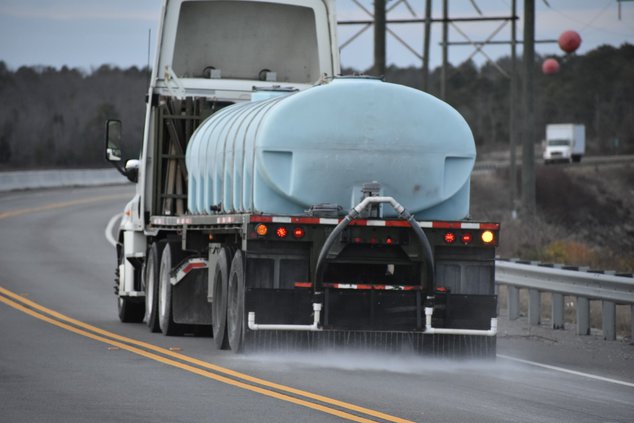
GEORGIA - Since the National Weather Service predicts a flash freeze Tuesday night into Wednesday morning, black ice is always a possibility and the reason Georgia Department of Transportation pretreats with salt-water brine.
GDOT maintenance forces along with contractor DBI Services will begin around 7 p.m. today spraying brine in the following areas and also Tuesday at 7 p.m.
- Interstate 20 from Newton County to Augusta;
- Interstate 520 Augusta area;
- Primary state routes north of I-20
- Georgia DOT teams will also salt potential bridge and overpass trouble spots Tuesday and Wednesday morning as needed in the same areas and in the southern part of our district around the I-16 corridor.
GDOT asks that drivers give these tankers and trucks space to work and know they must travel at slower speeds.
The latest NWS update says a strong cold front means black ice warnings to both north and central Georgia Tuesday, Jan. 29, with possible travel impacts as well as very cold temperatures lingering into Wednesday, Jan. 30. NWS points of focus include:
Black Ice: Black ice will be possible even in areas that receive little to no snow accumulation as temperatures drop below freezing through the day Tuesday but especially Tuesday night into Wednesday.
Wind Chills: Wind chills will drop into the low to mid teens across much of the area with single digits expected in the North Georgia mountains late Tuesday into Wednesday morning.
Gusty Winds: Winds will rapidly increase behind the cold front during the day Tuesday and persist into Tuesday night. Expect northwest winds around 15-20 mph with gusts up to 25-30 mph.


