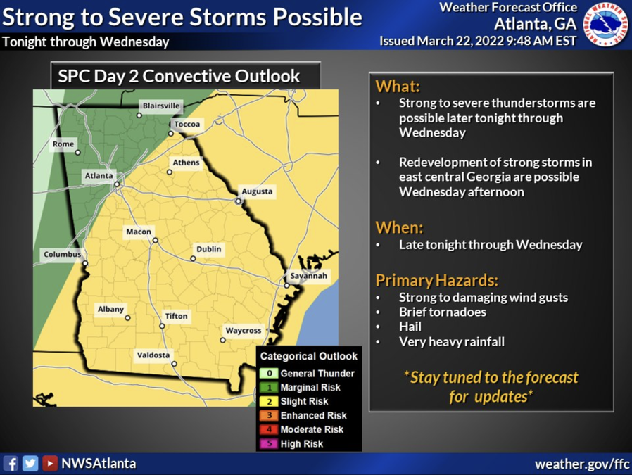

COVINGTON, Ga. — Newton County is among dozens of counties south of I-85 located within the "Slight Risk" zone for severe weather Tuesday night, March 22, per the National Weather Service.
But what exactly does that mean for area residents?
According to projections from the National Weather Service, there’s an increased chance of severe thunderstorms passing through the area Tuesday night and Wednesday. Potential hazards primarily include damaging winds, brief tornadoes, hail and heavy rainfall that could lead to localized flash flooding.
As of Tuesday morning, the National Weather Service predicts up to 1.5 inches of rainfall across the state from Tuesday to Thursday.
Wednesday’s temperatures are expected to range from a high of 73 degrees to a low of 50 degrees.
After the storm moves out Thursday, temperatures could drop into low-60s for the rest of the week before climbing back up to the 70s on Monday.
Stay weather aware and visit CovNews.com for weather updates as the forecast continues to develop.


