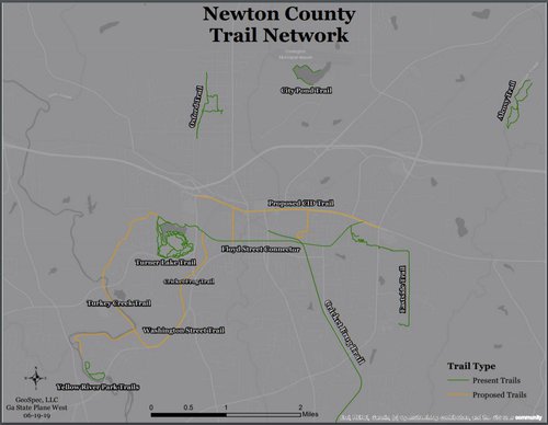
PORTERDALE, Ga. - Early this year Jon McBrayer hiked Newton County's current and proposed trails carrying a Garmin global positioning system. As he walked, that unit recorded the coordinates of his location every five seconds.

Later, using geographic information system software provided by a grant from the Earth Science Resource Institute, McBrayer connected the dots and created digital trail maps.
Now the data is ready for use in creating interactive maps on platforms such as Google Earth as well as maps suitable for use by local units of government, Newton Trails, and others in their publications, brochures, planning efforts, and for other purposes. McBrayer’s project will be wrapped up by the end of the summer.
McBrayer is a GIS certified, graduate student in public administration at Georgia College, Milledgeville. He is also president of GeoSpec a mapping, analytics, and consulting company.
His mapping work in Newton County is being done as part of an internship under the direction of Bob Thomson, Porterdale city manager, and with help from Greg Richardson, chair of the Newton Trails board of directors.
The idea for the project came from Thomson, who said, “I was looking at various maps trying to determine if there was one map with all the trails in their various stages of development; from what I could tell there was no such map.”
McBrayer and Thomson met through a Georgia College faculty member known to both.
Thomson and Richardson independently stressed a particularly exciting outcome of the project. That is, the Atlanta Regional Commission is integrating McBrayer's maps with its own, thus putting Newton County's trails on its map of trails throughout the Atlanta metropolitan area.


